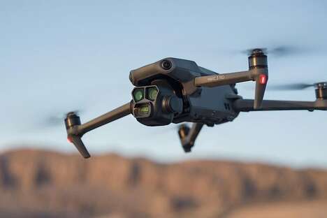
Lockheed Martin is using video footage taken by drones to create 3D maps with the company's Hydra Fusion tools. The most impressive aspect about Hydra Fusion is that it can build a 3D map in real time using the video feed from the drones.
Photogrammetry, which is the technique of minutely tracking features in a series of images to determine their size and positions, is applied for both scientific and military pursuits. Prior to Hydra Fusion, this process would have taken computers hours to examine the footage taken by drones to create a map. Lockheed Martin's ability to create 3D maps so much more efficiently could have important military value such as for reconnaissance missions or mapping unknown areas.
The map created by Hydra Fusion can clearly show details of the mapped area like trees and buildings. Higher resolution images for mapping can be generated when the drones are flying at slower speeds and low altitudes.
What's Driving This Trend
- Real-time 3D Mapping
- Lockheed Martin's Hydra Fusion tools enable the creation of 3D maps in real-time using video footage from drones, presenting opportunities for improved efficiency and accuracy in mapping various applications.
- Photogrammetry Advancements
- Lockheed Martin's use of photogrammetry techniques in creating 3D maps through drone video footage showcases the potential for advancements in scientific research and military operations.
- High-resolution Drone Mapping
- The ability to generate higher resolution maps by flying drones at slower speeds and lower altitudes opens doors for industries such as urban planning, agriculture, and construction, offering enhanced precision in data collection and analysis.
Who This Affects Most
- Military Technology
- The real-time 3D mapping capabilities of Lockheed Martin's Hydra Fusion tools can revolutionize reconnaissance missions and mapping unknown areas, transforming military operations and strategy.
- Scientific Research
- The application of photogrammetry in creating detailed 3D maps using drone video footage presents opportunities for advancements in scientific research fields such as archaeology, ecology, and environmental monitoring.
- Surveying and Mapping
- The high-resolution mapping capabilities facilitated by Lockheed Martin's Hydra Fusion tools can greatly benefit industries involved in surveying, urban planning, construction, and infrastructure development, streamlining data collection and analysis processes.