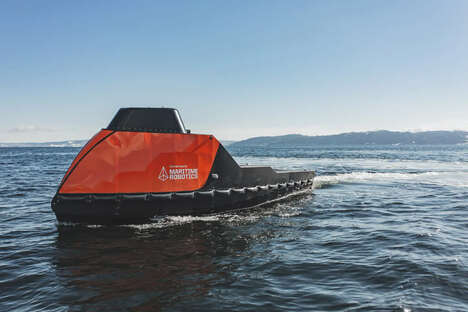


A team of scientists and engineers from the Fraunhofer Institute of Optronics, System Technologies and Image Exploitation over in Kalrsruhe, Germany have devised an innovative autonomous vessel that is designed to increase the precision and ease with water bodies are mapped, both in terms of surface qualities and their bottom topography.
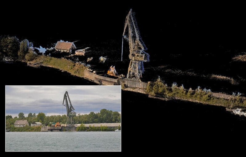
This autonomous vessel is equipped with high-tech sonar technologies that enable it to create 3D maps of the bottom of water bodies, with surface lasers and camera systems utilized in order to generate imagery of the shore. What's more, the bevy of technologies such as cameras, lasers and sensors are also to help the vehicle detect and avoid other watercraft without including their images in the final mapping output.
Ultimately, the advent of this autonomous vessel will make it possible for more accurate mapping of shorelines and waterbeds to be carried out with greater frequency than is possible with existing methods, albeit without adding undue expense.
Image Credit: Fraunhofer Institute of Optronics, System Technologies and Image Exploitation
Key Themes Behind This Trend
- Autonomous Vessels
- The development of water-mapping autonomous vessels presents opportunities for more efficient and precise mapping of water bodies.
- High-tech Sonar Technologies
- The integration of high-tech sonar technologies in autonomous vessels allows for the creation of detailed 3D maps of water bodies' bottom topography.
- Avoidance Systems for Watercraft
- The implementation of avoidance systems using cameras, lasers, and sensors in autonomous vessels enables safer navigation and mapping without including other watercraft in the final output.
Where This Applies
- Geospatial Technology
- The geospatial technology industry can leverage autonomous vessels to improve and streamline the process of mapping water bodies' surface qualities and bottom topography.
- Marine Exploration
- The marine exploration industry can benefit from water-mapping autonomous vessels to enhance the accuracy and frequency of mapping shorelines and waterbeds.
- Environmental Monitoring
- Water-mapping autonomous vessels offer opportunities for the environmental monitoring industry to gather more precise data about water bodies' conditions and changes.