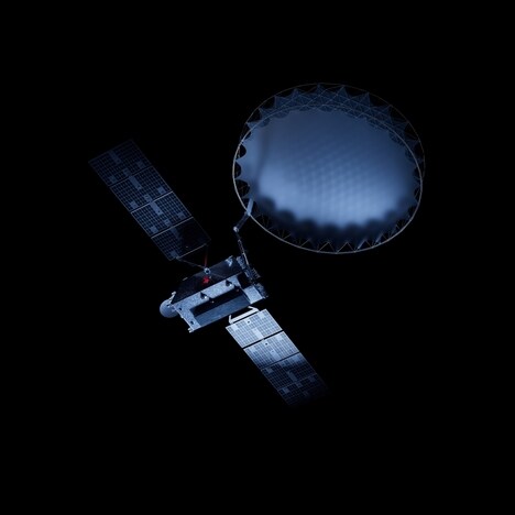
Hydrosat has unveiled its groundbreaking VanZyl-1 satellite, heralding a new era in commercial satellite technology with its high-resolution thermal imaging capabilities. Scheduled for launch aboard SpaceX's Transporter-11 from Vandenberg Air Force Base, VanZyl-1 marks a significant advancement in global environmental monitoring and agricultural management. Named in honor of Jakob van Zyl, a distinguished figure in space exploration, this satellite aims to revolutionize the understanding of global water stress and crop health through precise thermal infrared imagery.
The key innovation of Hydrosat's commercial satellite technology lies in its ability to provide frequent, high-resolution thermal imaging coverage of the entire Earth. This capability surpasses existing satellites by offering more comprehensive and timely data, which can be crucial for monitoring climate-related events affecting agriculture, aquaculture, and urban environments. By enhancing the frequency and quality of data collection, Hydrosat enables stakeholders to make informed decisions in real-time, optimizing agricultural practices, and mitigating environmental risks.
Image Credit: Hydrosat
What Makes This Trend Stand Out
- High-resolution Thermal Imaging
- Advancements in high-resolution thermal imaging can significantly enhance environmental monitoring and precision agriculture.
- Real-time Data Utilization
- The use of real-time data from satellites can revolutionize how stakeholders respond to climate-related events and manage resources.
- Comprehensive Earth Coverage
- New satellites providing comprehensive Earth coverage open up opportunities for detailed analysis of urban environments and natural ecosystems.
Sectors Adopting This
- Agricultural Technology
- Innovations in satellite imaging allow for more precise monitoring of crop health and water stress, benefiting the agricultural technology industry.
- Environmental Monitoring
- Enhanced thermal imaging from space satellites can greatly improve the accuracy and frequency of environmental monitoring efforts.
- Urban Planning
- Urban planning can be revolutionized with high-frequency, detailed satellite data that tracks environmental changes and supports sustainable development.