

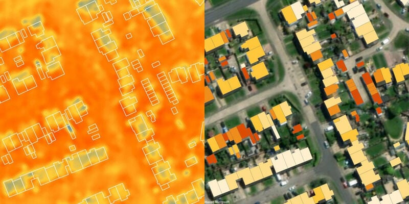
Data pertaining to energy inefficient buildings can be helpful to architects and urban planners who may use it to take action. Such data can help identify structures that may be retrofitted to be more sustainable or areas where the effect of "urban heat islands" should be countered by planting more trees, for example.
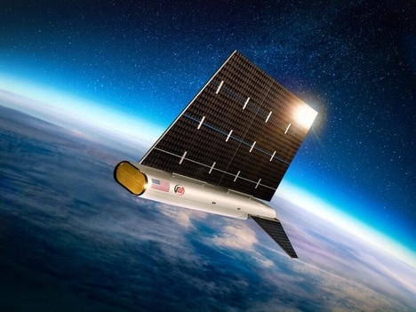
Recently, British technology company SatVu launched a special satellite into orbit with a Space X rocket. Described as "a thermometer in the sky," the Hotsat-1 satellite is designed to register energy inefficient buildings, thereby accelerating the data collection process. The Hotsat-1 is equipped with advanced thermal imaging technology and is capable of producing images with a high-enough resolution "to provide specific temperature data for any structure on the planet."
According to SatVu co-founder and CEO Anthony Baker, "Hotsat-1 represents a paradigm shift in commercial thermal imaging technology."
Image Credit: SatVu
Key Themes Behind This Trend
- Energy Efficiency Tracking
- Leveraging thermal imaging satellites to identify energy inefficient buildings offers opportunities for architects and urban planners to take action towards creating more sustainable structures.
- Urban Heat Island Mitigation
- Using data from thermal imaging satellites can assist in identifying areas affected by urban heat islands, leading to opportunities for implementing countermeasures like planting more trees.
- High-resolution Thermal Imaging
- The advancements in thermal imaging technology from satellites like Hotsat-1 provide specific temperature data for any structure on the planet, opening up possibilities for precise analysis and targeted improvements.
Where This Applies
- Architecture
- Architects can utilize thermal imaging satellite data to identify and retrofit energy inefficient buildings for improved sustainability.
- Urban Planning
- Urban planners can leverage the data collected by thermal imaging satellites to implement strategies for mitigating the effects of urban heat islands in specific areas.
- Satellite Technology
- The development of high-resolution thermal imaging satellites like Hotsat-1 presents opportunities for the satellite technology industry to advance and provide more specialized imaging solutions.