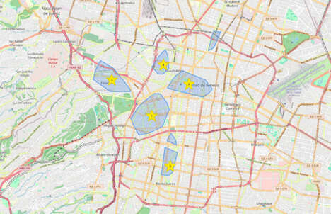
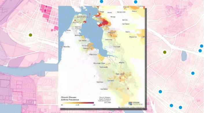
The COVID-19 pandemic has prompted businesses to lend a helping hand, including a new startup — Urban Footprint. The urban planning tool helps answer questions like "Which neighborhoods will have a hard time accessing groceries while under lockdown?" and "Which hospitals are closest to lots of seniors?"
This information is especially important as the virus will not be affecting every American equally. Factors like urban design and work from home options will vary from neighborhood to neighborhood and affect the impact of the virus. By understanding which neighborhoods are most vulnerable, nonprofits and governments will have a better gauge on which areas to send help to first.
As noted by Joe DiStefano, CEO and co-founder of Urban Footprint: “There are subsets of our population that don’t have automobiles and don’t have other ways to access essential services. So when the California governor gets up and says, ‘Hey, we’re going to use the National Guard to deploy food,’ where do you deploy that? Where do you have weakness in your system? I think those are the things that our system can readily do today.”
Image Credit: Urban Footprint
What Makes This Trend Stand Out
- Pandemic-fighting Digital Mapping
- There are immense opportunities for startups to create digital mapping tools to lend a helping hand to populations in crisis.
- Neighborhood Vulnerability Mapping
- As COVID-19 continues to affect American neighborhoods in different ways, startups can create tools to identify neighborhoods that are most vulnerable.
- Data-driven Disaster Relief
- There is a need for a data-driven approach to disaster relief efforts, presenting an opportunity for startups to develop platforms to support more effective resource allocation.
Sectors Adopting This
- Urban Planning
- Urban Footprint highlights the potential for urban planning tools to leverage data and provide valuable insights for disaster relief efforts.
- Nonprofit
- Nonprofits that leverage digital mapping tools can identify neighborhoods in need and direct resources more efficiently during times of crisis.
- Government
- Governments can benefit from digital mapping tools to support disaster relief efforts, particularly in targeting areas that need support the most.