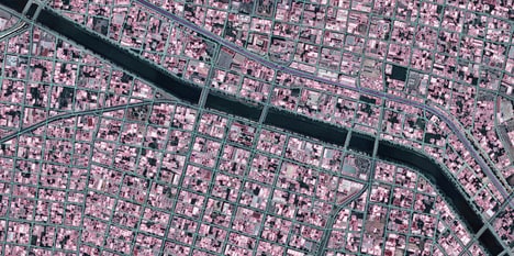
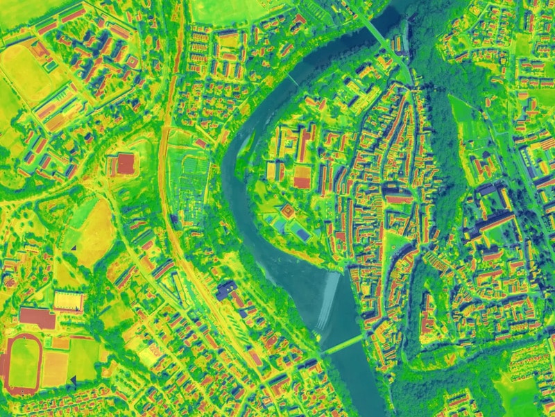
RealityMaps provides a comprehensive service for creating and managing digital replicas of urban environments. The process begins with the acquisition of high-resolution imagery using aerial and satellite platforms, which is then processed using artificial intelligence to identify and classify objects such as buildings, roads, and vegetation. This analyzed geospatial data forms the foundation of a digital twin, which is hosted on a cloud-based platform designed to facilitate urban planning, simulate various scenarios, and support public engagement.
RealityMaps' offerings cover the entire workflow of the digital twin creation — from initial data collection to the final analytical and visualization tools for the modeled urban landscape. The service, thus, goes beyond static maps and spreadsheets to a dynamic, interactive model that can simulate the real-world impact of planning decisions before any physical work begins.
Image Credit: RealityMaps
What's Driving This Trend
- AI-powered Urban Planning
- AI-driven modeling transforms how urban spaces can be virtually tested for efficiency and sustainability before implementation.
- Cloud-based Digital Twins
- Interactive digital twins hosted on the cloud offer scalable solutions for simulating urban development scenarios.
- High-resolution Geospatial Data
- The use of precise geospatial data empowers more informed decision-making in urban planning and infrastructure management.
Who This Affects Most
- Geospatial Technology
- Advancements in geospatial technology unlock new potential for accurate, data-driven insights into urban landscapes.
- Urban Planning Software
- Urban planning software evolves with digital twins, enabling more sophisticated and predictive modeling tools for city planners.
- Aerial Imaging and Analysis
- Enhanced aerial imaging capabilities increase the accuracy and applicability of spatial data in urban development projects.