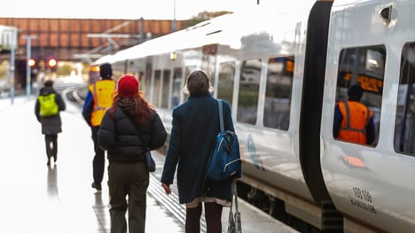
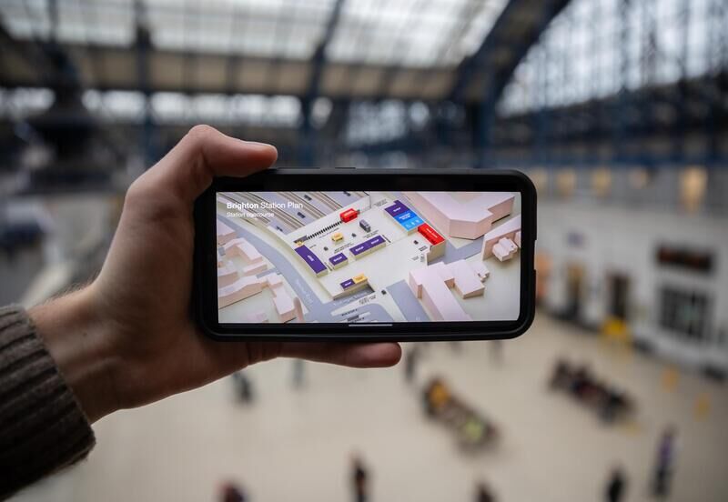
Govia Thameslink Railway’s introduction of 3D station maps marks a significant step toward enhancing accessibility and confidence for rail passengers, particularly those with disabilities. This innovation comes as geedback on existing 2D maps revealed usability gaps, especially at larger stations. Designed for mobile and computer use, these digital 3D station maps cover 10 key stations in London, Sussex, and Bedfordshire. The interface provides an interactive view that includes accessible routes, stairs, lifts, and ticket gates.
Govia Thameslink Railway’s 3D station maps address a common challenge for passengers who find navigating unfamiliar or complex stations overwhelming. The maps' bird's-eye views and color-coded routes simplify journey planning. The selection of pilot stations was guided by feedback from GTR’s access advisory panel and prioritized high-traffic or complex locations, such as Gatwick Airport and Denmark Hill. If the trial proves successful, additional stations may be added to the program.
Image Credit: Govia Thameslink Railway
What's Driving This Trend
- Digital Navigation Enhancements
- The shift from 2D to 3D digital maps signifies a move towards more intuitive navigation solutions for users requiring accessible transit information.
- 3D Mapping Revolution
- The emergence of 3D mapping technology in public transport systems highlights its potential to reshape user experiences by offering detailed spatial awareness.
- Inclusive Transit Solutions
- The development of detailed, accessible station maps reflects a broader trend towards inclusive design in public transportation to better serve diverse populations.
Who This Affects Most
- Public Transportation
- The integration of 3D maps in rail systems illustrates a growing focus on deploying technology to enhance user experience and accessibility within the public transport sector.
- Digital Mapping Services
- The application of 3D mapping for transit accessibility opens new avenues for companies specializing in cartographic and navigation technologies to cater to niche needs.
- Assistive Technology
- Advancements in digital wayfinding tools reflect opportunities in the assistive technology space to refine products that support individuals requiring additional navigation assistance.