Garmin, a brand that has achieved recognition as a leading marine electronics manufacturer, has unveiled a new 360-degree sonar system.
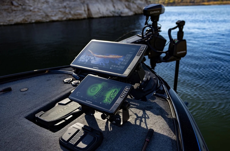
The integration of the GT360UHD transducer with the motorized Spy Pole enables users to scan and store sonar imagery across a wide area, then move freely without needing to constantly rescan, thanks to True Motion technology that maintains the sonar's true position relative to GPS. The ability to control the Spy Pole wirelessly via foot control, gesture remote, or directly through a compatible chartplotter gives anglers smooth, quiet, and precise command over their sonar, even while the boat is held in anchor lock. For those already using LiveScope live sonar, the addition of SpyLock technology allows them to lock the view on a specific point, while SpyScan mode automates sweeping searches, and SpyLink synchronizes control with the trolling motor for seamless operation.
Image Credit: Garmin
What Makes This Trend Stand Out
- Real-time Spatial Imaging
- High-resolution 360-degree sonar creates persistent environmental maps that enable precise situational awareness over wide areas without repeated rescanning.
- Motion-compensated Geolocation
- True Motion technology maintains accurate positional correlation between sonar returns and GPS while vessels drift or hold anchor, improving continuity of spatial datasets.
- Integrated Remote-control Interfaces
- Wireless foot controls, gesture remotes, and chartplotter synchronization provide multimodal command architectures that streamline operator interaction with sensing hardware.
Sectors Adopting This
- Recreational Fishing Tech
- Advanced live-scanning sonar augments angler targeting strategies by delivering near-instantaneous, directionally complete views of underwater structure and fish behavior.
- Maritime Search and Rescue
- Continuous 360-degree acoustic imaging supports more efficient localization of submerged objects and persons during search operations across variable sea states.
- Autonomous Marine Vehicles
- Synchronized sonar and navigation systems supply rich spatial inputs that could underpin obstacle-aware path planning and persistent environmental mapping for unmanned vessels.