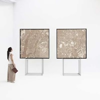


The entire Southeast side of Baltimore is a canvas for artist and cyclist Michael Wallace. This artist burns calories while working up a creative art collection. Wallace strategically whisks his way around city streets using GPS technology to track enormous city grid images.
These city-scale sketches form a series of contours that comprise of the Titanic, three-headed monsters, an 18-wheeler and more. He plans his routes carefully and at times, rides up to 17 miles for just a single GPS recording image. There are symbols, historic events and story characters incorporated in this 'virtual geographic adventures' series.
This brilliantly crafted art illustrations are a creative way to incorporate communal art that involves an entire city region. Michael Wallace rides through major city streets, small alleys and parks; it's vital to follow directions as each wrong turn will be game over.
Photo Credits: designboom, wallygpx
What's Driving This Trend
- GPS Art
- Opportunity for artists to create large-scale art using GPS technology.
- Communal Art
- Creating art that involves and engages an entire city region.
- Virtual Geographic Adventures
- Using GPS technology to create interactive stories and experiences in different locations.
Who This Affects Most
- Art and Design
- Incorporating GPS technology in art installations and outdoor sculptures.
- Tourism and Travel
- Developing interactive GPS-guided tours that offer unique experiences to visitors.
- Fitness and Wellness
- Creating fitness programs that combine exercise with artistic expression through GPS art.