

Google Maps' Underwater Street View Collection Dives Below the Surface
References: googleblog.blogspot.ro & blameitonthevoices
Google Maps' Underwater Street View launch takes the satellite brand underwater. For years, the Street View tool has been essential for urban planners, architects, and just about anyone looking to get from point A to point B.
The company's deep dive below the water's surface will reveal up close snapshots of turtles and manta rays as they swim about in Australia, the Philippines and Hawaii. Images of volcanic islands, ancient coral and craters will also prove essential to the research of marine biologists.
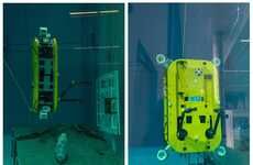
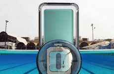
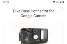
Google has collaborated with The Caitlin Seaview Survey, a scientific research group that specializes in international reefs, to put on the Underwater Street View project. Viewers who zoom in and out of the panoramic frames will get to zero in on all types of fishy activity.
The company's deep dive below the water's surface will reveal up close snapshots of turtles and manta rays as they swim about in Australia, the Philippines and Hawaii. Images of volcanic islands, ancient coral and craters will also prove essential to the research of marine biologists.
Google has collaborated with The Caitlin Seaview Survey, a scientific research group that specializes in international reefs, to put on the Underwater Street View project. Viewers who zoom in and out of the panoramic frames will get to zero in on all types of fishy activity.
Trend Themes
1. Underwater Exploration - Google Maps' Underwater Street View Collection showcases the trend of exploring underwater environments using immersive technology.
2. Marine Conservation - The collaboration between Google and The Caitlin Seaview Survey highlights the trend of using technology to promote awareness and research in marine conservation.
3. Virtual Tourism - The launch of Underwater Street View by Google Maps taps into the trend of virtual tourism, allowing users to explore and learn about underwater ecosystems from the comfort of their homes.
Industry Implications
1. Travel and Tourism - The use of underwater panoramic images in Google Maps opens up new opportunities for the travel and tourism industry to offer virtual experiences to potential customers.
2. Technology and Innovation - The development of immersive technologies for underwater exploration presents disruptive innovation opportunities in the technology and innovation industry.
3. Environmental Research - The Underwater Street View project by Google Maps provides valuable data for marine biologists and researchers, contributing to the advancements in the environmental research industry.
1.8
Score
Popularity
Activity
Freshness