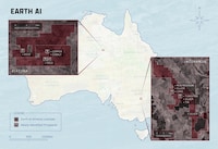


RES is expanding project screening with 'EcoSite IQ,' a patent-pending method that scans large areas at once, enabling public- and private-sector clients to narrow land and water prospects before deeper site work. It uses predictive analytics and automated mapping to integrate location, water, and ecological models, ranking projects without parcel-by-parcel review.
Early use has focused on water-resource work, where the method has flagged projects estimated to produce 26 million to 665 million gallons per year. Looking across terrain and flow patterns together can surface high-yield sites sooner, allowing teams to reserve detailed engineering for stronger candidates.
In practice, EcoSite IQ serves as a regional first pass, pulling terrain, engineering, and ecological inputs into a single view before field teams move in. RES is extending it to water-quality credits and watershed restoration, and a provisional patent application is on file.
Image Credit: RES
Why This Trend Is Growing
- Predictive Site Screening
- AI-enabled geographic analysis is reshaping early-stage project planning by identifying high-potential land and water assets before costly field assessments begin.
- Automated Watershed Intelligence
- Integrated terrain, flow, and ecological modeling creates new value in ranking watershed opportunities at regional scale with greater speed and consistency.
- Credit-ready Restoration Mapping
- Data-driven environmental screening supports emerging markets for water-quality credits by connecting restoration potential with measurable ecological outcomes.
Industries Being Reshaped
- Environmental Consulting
- Advanced mapping platforms expand consulting services from manual assessment toward scalable, analytics-led project prioritization.
- Water Resource Management
- Regional screening tools improve visibility into water supply, yield, and restoration prospects across complex landscapes.
- Geospatial Analytics
- Predictive ecological modeling opens commercial pathways for location intelligence providers serving infrastructure, conservation, and resource planning markets.