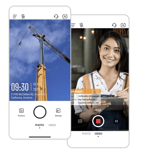
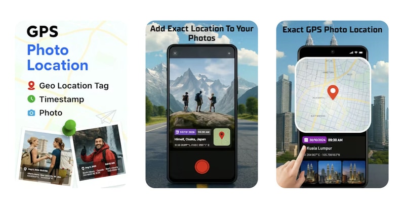
GeoCam: GPS Photo Location is a mobile application designed to integrate geolocation data into photographs automatically. The app captures photos with embedded GPS coordinates, date, and time stamps, allowing users to organize and reference images by location.
This functionality is particularly useful for travelers, content creators, and professionals who require accurate contextual information for images. By automating location tagging, GeoCam reduces the need for manual record-keeping and simplifies photo management across devices and cloud storage platforms. The app exemplifies a growing trend in mobile photography where metadata enrichment enhances organizational efficiency and content usability. For businesses and individuals, GPS-enabled photography tools like GeoCam provide a structured approach to archiving, reporting, and storytelling, making visual documentation more informative, searchable, and actionable across personal and professional workflows.
Image Credit: GeoCam
What's Driving This Trend
- Location-enriched Photography
- Embedding precise GPS metadata into images enables automated contextual storytelling and searchable visual archives for large-scale content operations.
- Automated Metadata Tagging
- Standardized timestamp and coordinate embedding creates opportunities for interoperable asset management across devices and cloud platforms.
- Contextual Visual Documentation
- Professionals can rely on location-verified imagery to strengthen compliance reporting, insurance claims, and forensic evidence chains.
Who This Affects Most
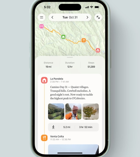
- Travel and Tourism
- Geo-tagged photos create enriched itineraries and personalized destination analytics for experience-driven monetization.
- Insurance and Claims
- Timestamped, GPS-verified imagery has potential to streamline loss verification and fraud reduction through immutable photo records.
- Construction and Field Services
- Site photos with embedded coordinates and times enable progress tracking, remote inspections, and contractual compliance monitoring.