


NASA Satellite Returns Images of US Wildfires
Rose A. Valenta — May 2, 2007 — Eco
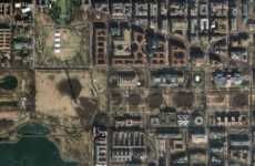
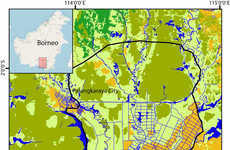
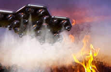
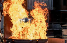
As NASA's Terra satellite passed over the State of Georgia, it picked up images of the wildfires that have been burning in the Southeast. The fires began on April 27, 2007, and continue to ravage Florida and Georgia, consuming roughly 50,000 acres.
Implications - Satellite photos are important to not only scientists, but consumers as well. They are curious to see views of Earth that they never dreamed they would be able to. Companies that enable their target market to explore, learn and visualize the world in a different way or from a different perspective will hook potential consumers who are intrinsically inquisitive.
Implications - Satellite photos are important to not only scientists, but consumers as well. They are curious to see views of Earth that they never dreamed they would be able to. Companies that enable their target market to explore, learn and visualize the world in a different way or from a different perspective will hook potential consumers who are intrinsically inquisitive.
Trend Themes
1. Satellite Imaging - Opportunity to develop and provide satellite imaging solutions for consumers, businesses and scientists.
2. Natural Disaster Monitoring - Opportunity to create products and services for tracking and analyzing natural disasters using satellite imagery.
3. Environmental Awareness - Opportunity to use satellite imagery to raise awareness about environmental issues and influence behavior change.
Industry Implications
1. Technology - Technology sector can leverage satellite imagery for various applications and services.
2. Environmental Conservation - Environmental conservation organizations can use satellite imagery to monitor and track natural disasters.
3. Media and Marketing - Media and marketing companies can use satellite imagery to create compelling visuals and content for their audience.
5
Score
Popularity
Activity
Freshness